Mt. Colvin and Blake Peak, May 12, 2017
First did Colvin back in 2006
Blake Peak had eluded me back in 2006 and was the only peak I needed in the general area that can be accessed via the Lake Road on AMR land. There really is no "easy" way to access this peak for a day trip. If you come from the Elk Lake area, it's a very long hike. If you trek from the north like I did this day, you must ascend and descend Colvin to get to it and it's 14.6 miles round trip.
This trip was planned and cancelled a few weeks prior due to the incredible amount of rain we had, so I would be going solo since the Mountain Goat had a prior commitment. The weather this day was incredible however, low 40's in the morning and a high of about 60 with low humidity and a light breeze.
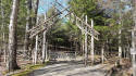
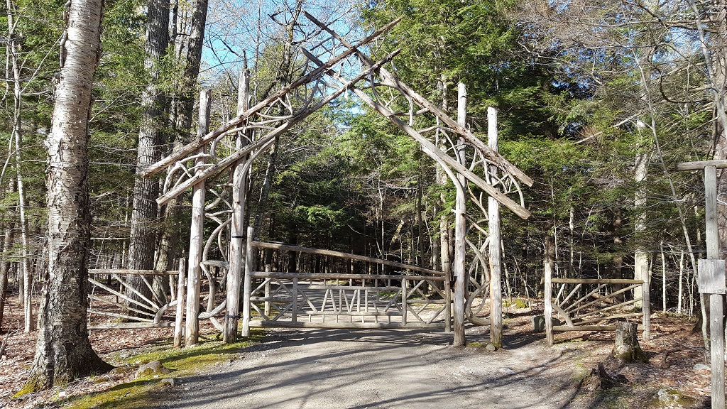
I reached the St Hubert's parking area by 8am and started the trek on the dirt road to the AMR gate.
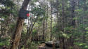
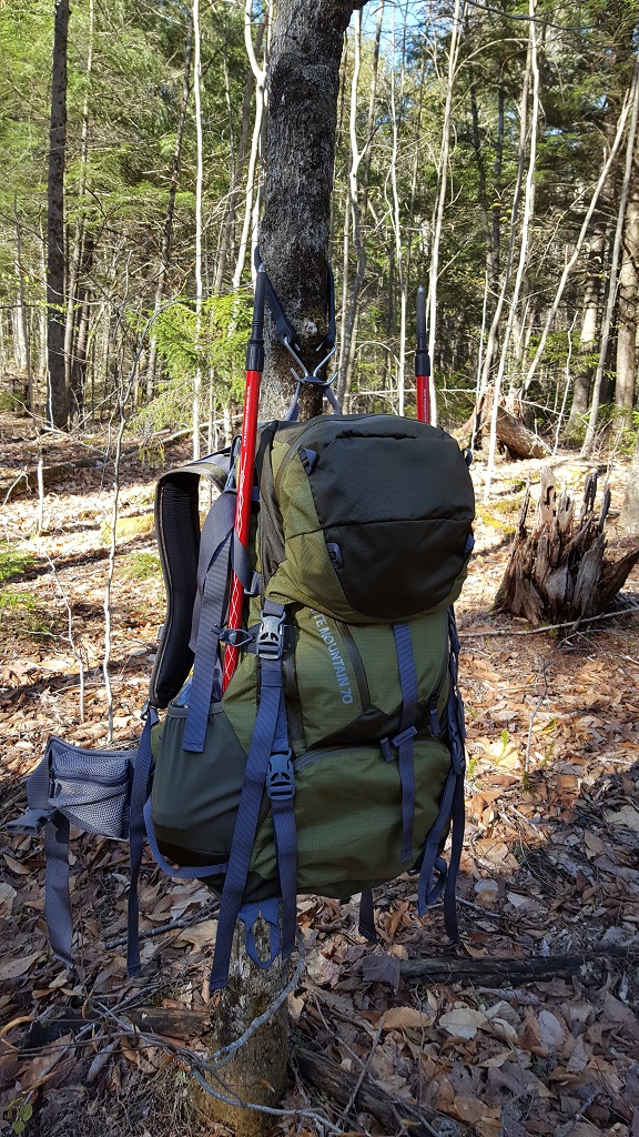
 My hiking partner for the day,
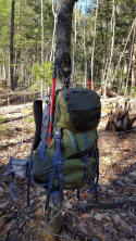 I wonder if I can get him to carry my pack?
If you've ever been, you know of the many flumes and clear pools along the Lake Road as you head toward your chosen trailhead and peak destination.
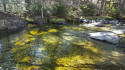 Looks so inviting, I bet it's very cold though.
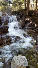
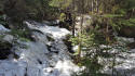
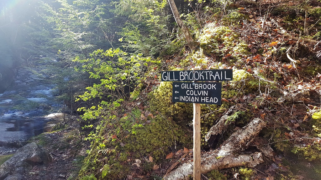
There are a few options for ascending Colvin, but I decided on the most direct route via the Gill Brook trail. It follows the water for quite some time as you gradually gain altitude. There's something about hiking alongside the running water that has always appealed to me anyway.
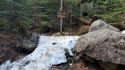
 This little water fall greets you as you turn from the Lake Road and
begin the gradual ascent, very nice!
This little water fall greets you as you turn from the Lake Road and
begin the gradual ascent, very nice!
The trek along the Gill Brook trail is very scenic and it's tempting to stop and take pictures of every flume, clear pool, and waterfall, but I knew I had a long day ahead of me so I opted for the "easy" route when given the choice.
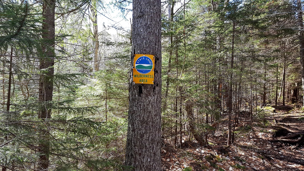
You eventually leave the AMR property and enter "my" land. There are a few primitive campsites here as well.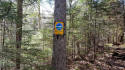

I reached this junction at 10 am exactly, not too bad for 4.2 miles, so I took a short break to hydrate and snack. From here the ascent becomes more steady as well, and as I started to gain altitude a little while later the snow started to appear and the ascent became less "gradual" to say the least. The last 1.1 miles to Mt Colvin's summit is fairly aggressive.
The trail went from this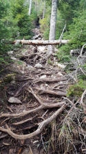 to this
 the rest of the way until the final short push to the summit
here (short video).
the rest of the way until the final short push to the summit
here (short video).
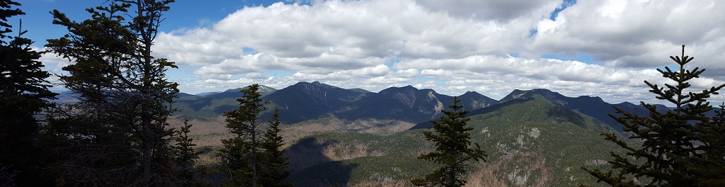
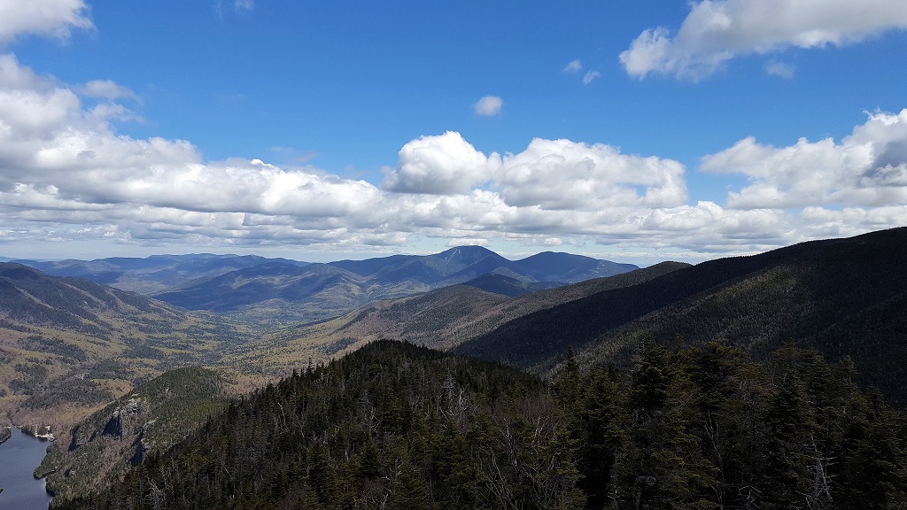
So I made the summit of Mt. Colvin by 11:30 and I was feeling pretty good about the pace, but knew I had a lot of work ahead of me. I could have stayed up there all day, it was so clear and the entire Great Range can be seen from the peak, not to mention the Ausable Lake and the cliffs way down below.
I did hang out for a while and soaked it in and managed some really nice VFTT photos including the top banner for this page. The 3 photos below are from right to left ( or North to West) starting with the Upper Ausable Lake and Giant Mountain, then the northern Great Range and finally the rest of the Great Range with Marcy, Haystack and Skylight in full view.
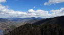

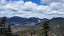
Another awesome Panorama from Colvin's summit.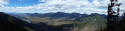
Well, I had to eventually head south and tackle the col between Colvin and Blake so I could accomplish the main goal for today. The descent and ascent proved to be very challenging, it's not very far but quite steep in both directions. The snow "spine" on the trail did not make for easy walking by any means either. I was really feeling the effects of the day by the time I summited Blake peak.
 Always nice to see ladders to assist, especially when your legs are
starting to feel like rubber.
Always nice to see ladders to assist, especially when your legs are
starting to feel like rubber.
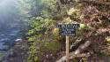
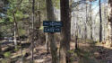
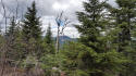
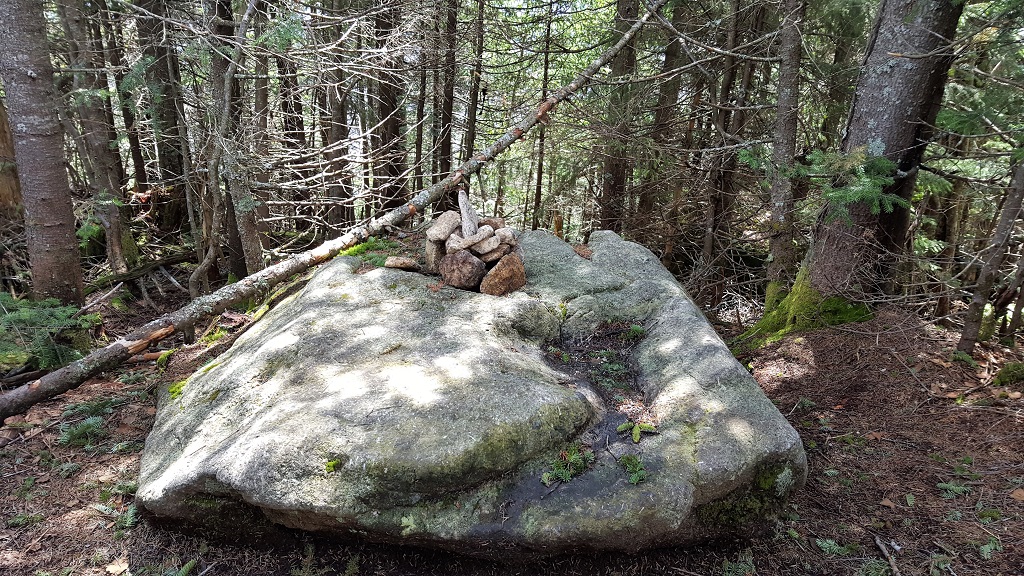
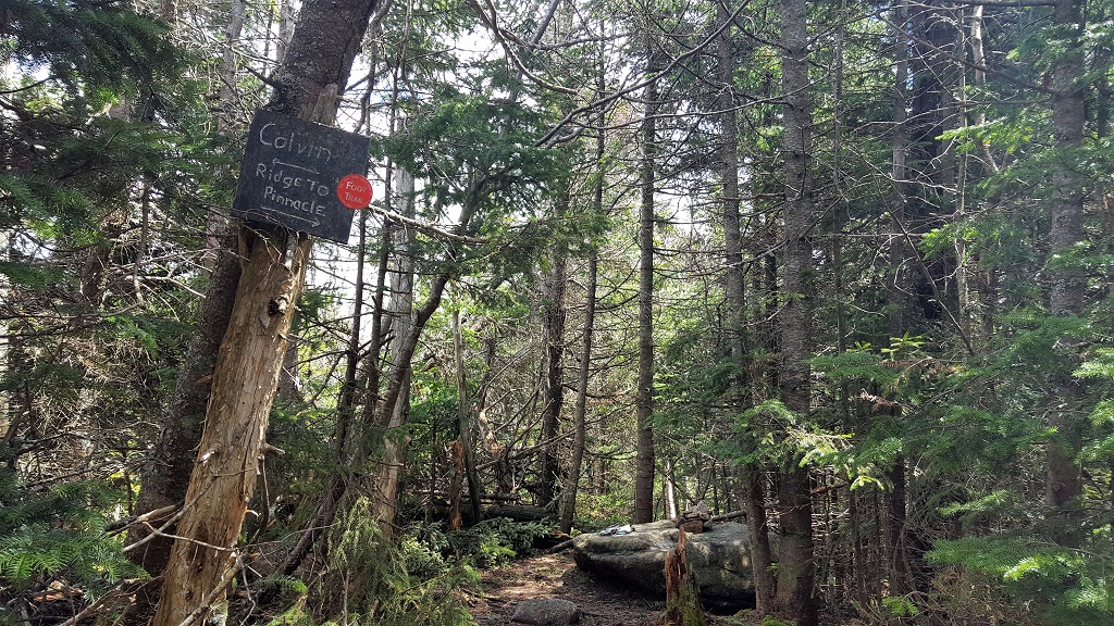
The peak itself is wooded although you can see a section of the Great Range peeking through the trees. The only real indication that you are there is a small cairn on a large rock and the junction sign.

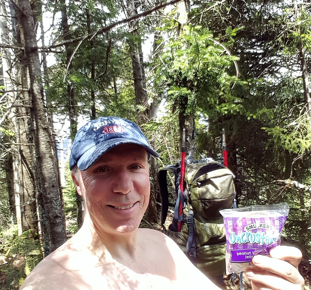
Nothing like an un-crustable PB&J as my reward as I attempt to dry my shirts in the sun. Cheers! Full disclosure, I ate two of them.

Well, with Blake Peak (#32) completed, I now only had the steep col to conquer and 7.3 miles to go to my car :(
I was pretty worn out by the time I reached the Lake Road, but it was well worth it. In the end my hiking partner was still there, although he didn't help me carry anything.
Blake Peak had eluded me back in 2006 and was the only peak I needed in the general area that can be accessed via the Lake Road on AMR land. There really is no "easy" way to access this peak for a day trip. If you come from the Elk Lake area, it's a very long hike. If you trek from the north like I did this day, you must ascend and descend Colvin to get to it and it's 14.6 miles round trip.
This trip was planned and cancelled a few weeks prior due to the incredible amount of rain we had, so I would be going solo since the Mountain Goat had a prior commitment. The weather this day was incredible however, low 40's in the morning and a high of about 60 with low humidity and a light breeze.
I reached the St Hubert's parking area by 8am and started the trek on the dirt road to the AMR gate.
 My hiking partner for the day,
 I wonder if I can get him to carry my pack?
If you've ever been, you know of the many flumes and clear pools along the Lake Road as you head toward your chosen trailhead and peak destination.
 Looks so inviting, I bet it's very cold though.
There are a few options for ascending Colvin, but I decided on the most direct route via the Gill Brook trail. It follows the water for quite some time as you gradually gain altitude. There's something about hiking alongside the running water that has always appealed to me anyway.
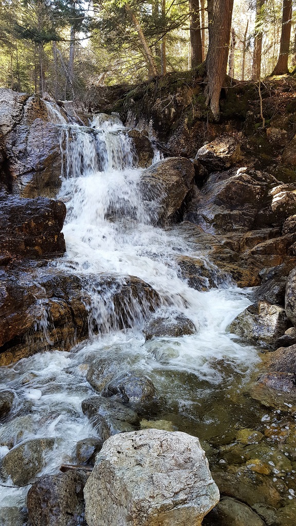 This little water fall greets you as you turn from the Lake Road and
begin the gradual ascent, very nice!
This little water fall greets you as you turn from the Lake Road and
begin the gradual ascent, very nice!The trek along the Gill Brook trail is very scenic and it's tempting to stop and take pictures of every flume, clear pool, and waterfall, but I knew I had a long day ahead of me so I opted for the "easy" route when given the choice.

You eventually leave the AMR property and enter "my" land. There are a few primitive campsites here as well.
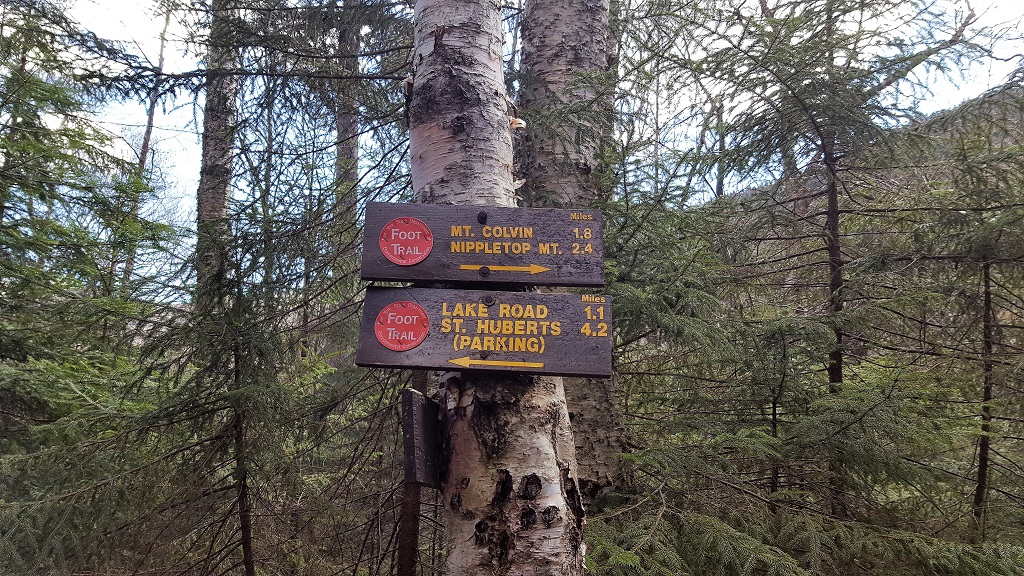
I reached this junction at 10 am exactly, not too bad for 4.2 miles, so I took a short break to hydrate and snack. From here the ascent becomes more steady as well, and as I started to gain altitude a little while later the snow started to appear and the ascent became less "gradual" to say the least. The last 1.1 miles to Mt Colvin's summit is fairly aggressive.

The trail went from this
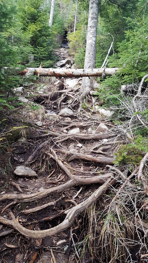 to this
 the rest of the way until the final short push to the summit
here (short video).
the rest of the way until the final short push to the summit
here (short video).So I made the summit of Mt. Colvin by 11:30 and I was feeling pretty good about the pace, but knew I had a lot of work ahead of me. I could have stayed up there all day, it was so clear and the entire Great Range can be seen from the peak, not to mention the Ausable Lake and the cliffs way down below.
I did hang out for a while and soaked it in and managed some really nice VFTT photos including the top banner for this page. The 3 photos below are from right to left ( or North to West) starting with the Upper Ausable Lake and Giant Mountain, then the northern Great Range and finally the rest of the Great Range with Marcy, Haystack and Skylight in full view.
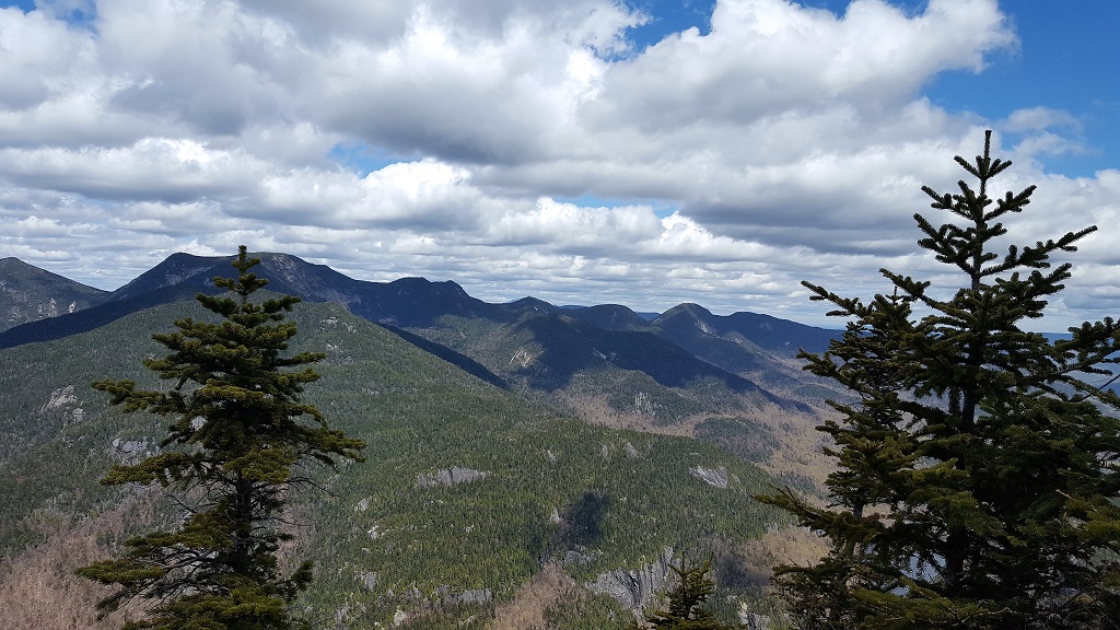
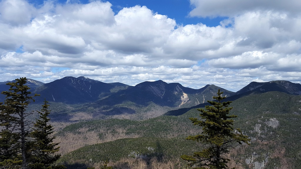
Another awesome Panorama from Colvin's summit.
Well, I had to eventually head south and tackle the col between Colvin and Blake so I could accomplish the main goal for today. The descent and ascent proved to be very challenging, it's not very far but quite steep in both directions. The snow "spine" on the trail did not make for easy walking by any means either. I was really feeling the effects of the day by the time I summited Blake peak.
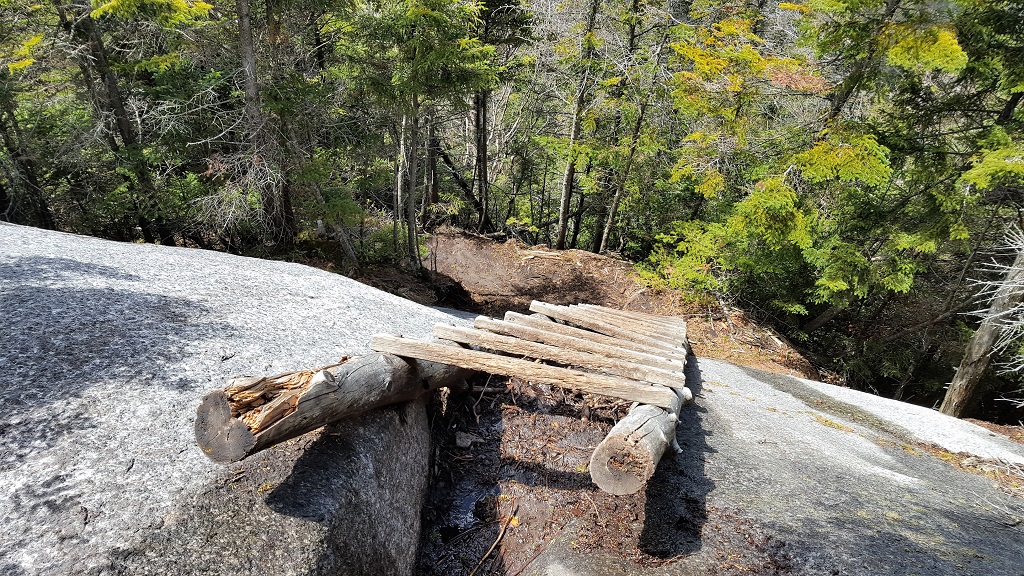 Always nice to see ladders to assist, especially when your legs are
starting to feel like rubber.
Always nice to see ladders to assist, especially when your legs are
starting to feel like rubber.The peak itself is wooded although you can see a section of the Great Range peeking through the trees. The only real indication that you are there is a small cairn on a large rock and the junction sign.

Nothing like an un-crustable PB&J as my reward as I attempt to dry my shirts in the sun. Cheers! Full disclosure, I ate two of them.
Well, with Blake Peak (#32) completed, I now only had the steep col to conquer and 7.3 miles to go to my car :(

I was pretty worn out by the time I reached the Lake Road, but it was well worth it. In the end my hiking partner was still there, although he didn't help me carry anything.
Back to Top